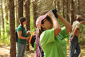
Students will learn about succession by studying the reestablishment of ecological communities following the 1980 volcanic eruption of Mount St. Helens and by setting up experimental plots to observe successional changes over time.
This is one of 9 activities that can be found in PLT’s Exploring Environmental Issues: Focus on Forests module. To get the activity, attend a training and receive PLT’s Focus on Forests secondary module. Below are some supporting resources for this activity.
RECOMMENDED READING 
Expand your students’ learning and imaginations. Help students meet their reading goals, while building upon concepts learned in this activity, with the following children’s book recommendations:
ADDITIONAL RESOURCES 
The following tools and resources may be used to enhance the activity.
-
Hardwood Ecosystem Experiment
Forest management in the eastern United States is faced with many modern challenges. To address the changes, researchers designed a long-term, large-scale experimental study of forest management and its impacts on plants and animals. This study, referred to as the Hardwood Ecosystem Experiment, is in its 10th year and there are already some interesting findings.
-
Living with Wildlife: Snags
What is a snag? How do dead and dying trees benefit the ecosystem? Learn how dead trees can actually provide more habitats for wildlife than when they are alive with Snags—The Wildlife Tree, published by Washington state Department of Fish & Wildlife. The article highlights species that use snag trees to survive, what kinds of trees make the best snags, and how to create a snag tree for wildlife. For more species fact sheets and ways to attract wildlife to your yard, check out this Living with Wildlife series.
-
Identify Trees from Leaves
Leafsnap is a free app that uses visual recognition software to help identify tree species from leaf photographs you take in the field. Leafsnap currently focuses on tree species found in the Northeastern United States and Canada, but expansion is underway to include all U.S. regions.
-
Find Nearby Trails and Parks
AllTrails is a free app that helps users discover the outdoors. Use it to find a hiking path suitable for children, to search for local places to bike or fish, or to plan a national park visit.
-
Into the Outdoors – Forest Ecology
Into the Outdoors is an Emmy award-winning TV show with an emphasis on science education for middle school-aged students. The show’s new website, intotheoutdoors.org, provides free videos and other resource links on many environmental topics to make outdoor learning exciting and fun. While there are many exciting topics to choose from (such as sustainable forestry, biodiversity, and wetlands), Into the Outdoor’s 4-part video series on Forest Ecology is a perfect fit with many Project Learning Tree activities. These 5-7 minute shorts feature middle school-aged youth that inspire all of us to take learning outdoors!
-
SoilWeb
A free app that can be downloaded onto Apple and Android devices. A more technical application, SoilWeb allows users to access GPS based, real-time USDA-NRCS soil survey data. Using your geographic location, this app retrieves soil type summaries, including soil series names and image profiles.
-
EasyMeasure
A free app that can be downloaded onto Apple devices (SmartMeasure for Android). EasyMeasure uses the height of the camera lens and its tilt angle to calculate the distance to objects of your choice. Simply aim your mobile device at any object, and this app displays the distance towards that object on top of the camera image. Upgrades can be used to also calculate object height.
-
WildLab Bird
A free app that can be downloaded onto any Apple device (try iBird Lite for Android). Use WildLab Bird to learn the basics of bird identification. This application uses audio, photographs, maps, and the process of elimination to help identify over 200 bird species. Sightings can also be entered into a national bird watching database for comparison.
-
Easy Chart
A free app that can be downloaded onto Apple devices. This is a good tool for teachers and classrooms. Easily create bar, line and pie charts that you can customize, save and e-mail or upload. The charts you create can be saved using multiple color schemes and in multiple sizes. The app also works without an internet connection.
-
EnviroAtlas
EPA’s new EnviroAtlas tool is designed to help communities and researchers make informed planning and policy decisions related to the environment and ecosystems. EnviroAtlas provides datasets and interactive tools to allow users to explore the many benefits people receive from nature, often referred to as ecosystem services. EnviroAtlas includes over 300 data layers, letting users analyze how decisions affect ecosystems and their ability to provide goods and services. Key components include:
-
Global Forest Watch
Global Forest Watch (GFW) is an interactive online forest monitoring and alert system designed to better visualize forest change across the globe. Developed by the World Resources Institute and partners, Global Forest Watch monitors forests across the world in near real time to show where trees are growing and disappearing. The system provides contextual data that fleshes out complex issues surrounding deforestation. It can be utilized by teachers for classroom demonstrations and activities, and by students for research.